KITCHENER -- Heavy rain continues for parts of Southwestern Ontario, along with the risk of thunderstorms to start the weekend.
The heaviest rain Friday morning fell in areas toward Windsor – Essex. The Essex Region Conservation Authority has issued a flood warning due to the accumulation of rain across parts of that region. The ERCA says in a release “the Turkey Creek watershed which includes the Grand Marais Drain through the City of Windsor has exceeded 100mm of rainfall today.”
Some roads have closed and there have been several reports of flooding.
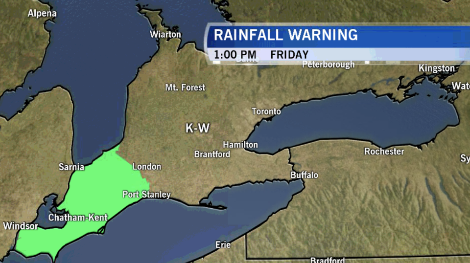
Environment Canada has issued a rainfall warning for parts of Southwestern Ontario for this event.
Special Weather Statements have also been expanded for 30 to 60mm of rain, including in Waterloo Region, Huron, Perth, Oxford and Brant Counties. The front associated with an area of low pressure will push north with increased rain locally through the day and overnight, especially in thunderstorms. This system is tapping into moisture from the Gulf of Mexico associated with what was Hurricane Laura.
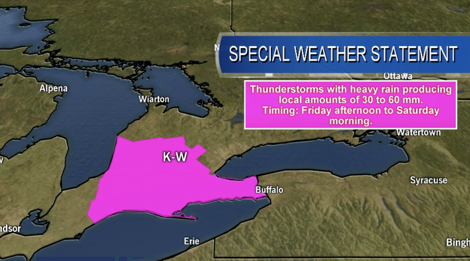
Strong thunderstorms are possible producing locally higher amounts of rain as well as strong winds. Environment Canada says in a special weather statement that there is still much uncertainty regarding exact locations of heavy rain and rainfall amounts. Rainfall warnings may be issued.
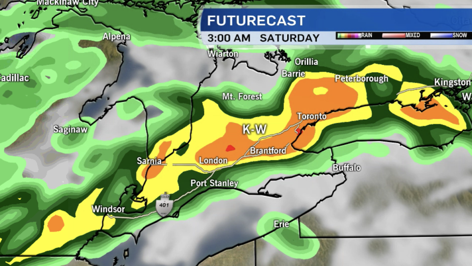
The chance of rain and thunderstorms lingers early Saturday with a strong NW wind gusting 30-50km/h into the afternoon. Conditions will gradually clear Saturday and a mix of sun and clouds is forecast for Sunday along with cooler temperatures.


