
KITCHENER -- Temperatures are frigid for millions of Canadians as the Polar Vortex makes its presence known, but some in southern Ontario have yet to reach -20 degrees Celsius this winter.
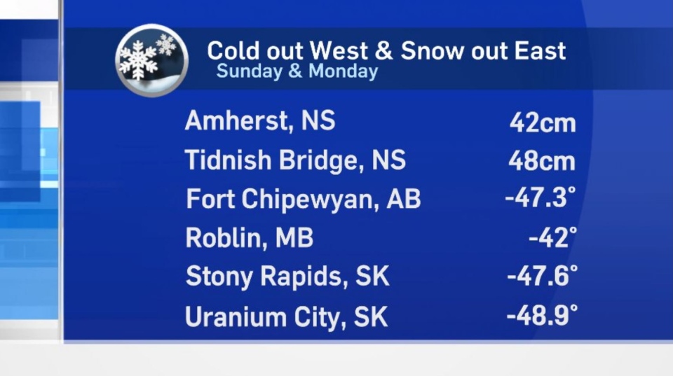
In parts of Western Canada dipped to near -50 C in recent days, prompting extreme cold warnings from British Columbia to northwestern Ontario.
WOULD YOU RATHER -50 C OR 50 CM OF SNOW?
Too cold to snow? Maybe in the west, but not in the east. Parts of Atlantic Canada recorded near 50 centimetres of snow Sunday and Monday as a potent system impacted the provinces on the east coast.
Temperatures in southern Ontario have certainly been brisk, with daytime highs trending below seasonal the past few days. Although it’s been cold, some communities in Southern Ontario have yet to drop to -20 C, including at the Region of Waterloo International Airport, where temperature data is recorded.
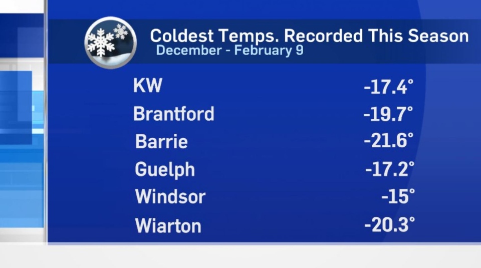
The lowest temperature recorded at YKF so far this season is -17.4 C on Feb. 7. The coldest maximum temperature recorded at the airport this season was -9.8 C, on Feb. 8, well off our seasonal average for a daytime high of -3 C.
There’s no doubt temperatures are bitterly cold at times and we are experiencing the coldest air of the season so far. Temperatures in southern Ontario remain below seasonal for at least the next week.
Waterloo Region has a good shot at hitting its first -10 C high and -20 C low of the season late this week or the weekend.
Not a fan of winter? Here’s some good news. Sunrise in Waterloo Region is just before 7:30 a.m. and sunset is approximately 5:45 p.m.! And it gets better: meteorological spring is less than three weeks away (March 1) while, astronomical spring is also right around the corner (March 20).


