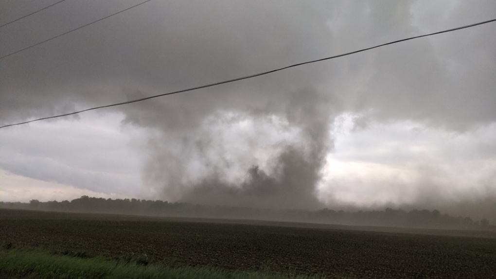
KITCHENER -- The severe weather on June 10 caused tornadoes in parts of Southern Ontario. The Northern Tornadoes Project from Western University has added more to the list, which now includes seven.
The first two tornadoes to be confirmed happened near London on the evening of June 10.
Tornados are rated on the Enhanced Fujita (EF) scale and are given a number between zero and five.
One EF-1 was in the Belmont area, with max winds of 150km/h and a path length of 18 km.
The other was surveyed in the Glencoe area as an EF-0 with max winds of 130km/h and a path length of 17 km, both tornadoes leaving behind damage.
The Northern Tornadoes Project posted an update to the tornado count roughly a week later, as more damage was investigated near cottage country.
The team identified three new tornadoes and said they are continuing to investigate other reports from this date.
An EF-1 tornado was identified in Bracebridge with winds of 150km/h and a path length of 5.6 km removing more than half of a barn roof.
An EF-1 also moved through Baysville, too, with winds of 145km/h with a path length also of 5.6 km. The third and strongest tornado added to the list during this update was in Mary Lake near Huntsville, with a rating of EF-2, winds of 190km/h and a path length of 24.6 km
Meanwhile, two other tornadoes have recently been added to the list as well. An EF-0 moved through Belgrave with a path length of 5.5 km causing damage to trees and farm hutches.
A tornado was also confirmed in Brussels, Ont., an EF-0 with a path length of 3.1 km causing damage to trees.


