How a Wilfrid Laurier researcher is using advanced technology to improve ice roads
A Wilfrid Laurier researcher is using advanced technology to better understand ice roads in Canada’s far north.
Canada Research Chair in Remote Sensing of Environmental Change Homa Kheyrollah Pour has worked with the community of Délı̨nę, N.W.T. for the last few years to help monitor the ice roads the region rely on.
“I would know how much ice actually grew last night, because the sensor will send this to us. These sensors can be installed in a remote area that you don’t have to be there to measure it,” Kheyrollah Pour said.
No highway infrastructure exists around Délı̨nę, so the majority of supplies cannot be brought in during the summer. Most supplies are delivered in the winter, using ice roads that play an extremely important role for resupply. Around 80 to 100 vehicles a day use the connections.
“That kind of real time information is helpful to us in terms of planning additional profiles to measure the ice thickness, and determining how fast ice grows over an identified period,” Dustin Dewar, regional highway manager, Dehcho & Sahtu Regions, Government of Northwest Territories, said.
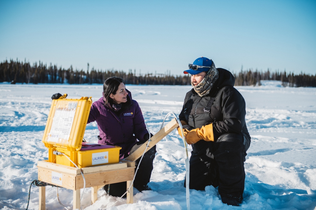
 Homa Kheyrollah Pour has been working with the community of Délı̨nę, N.W.T. for the last few years to monitor ice roads in the region. (Wilfrid Laurier University)
Traditional knowledge has be used for years to help build these ice roads, but now with research using ground-penetrating radar systems, drones and satellites, it helps determine when weight limits can be increased for a safer and more efficient approach.
“In the past we would use general rules of thumb to estimate approximately when we would be taking the next profile, but having this real time information it’s very helpful in planning,” Dewar said.
While each ice road is different, researchers say the technology can be used for other connections. It helps monitor how the climate is changing and how long the ice is safe.
“In real time we can map it, and then they can look at it on the screen and say ‘okay, so along this pressure region maybe that area is the best and safer,” Kheyrollah Pour said.
The residents of Délı̨nę are also being trained to do the monitoring themselves.
“Community members and youths can use this kind of technology to take it over, and they can actually monitor their own land,” Kheyrollah Pour said.
CTVNews.ca Top Stories

opinion Tom Mulcair: Prime Minister Justin Trudeau's train wreck of a final act
In his latest column for CTVNews.ca, former NDP leader and political analyst Tom Mulcair puts a spotlight on the 'spectacular failure' of Prime Minister Justin Trudeau's final act on the political stage.
B.C. mayor gets calls from across Canada about 'crazy' plan to recruit doctors
A British Columbia community's "out-of-the-box" plan to ease its family doctor shortage by hiring physicians as city employees is sparking interest from across Canada, says Colwood Mayor Doug Kobayashi.
'There’s no support': Domestic abuse survivor shares difficulties leaving her relationship
An Edmonton woman who tried to flee an abusive relationship ended up back where she started in part due to a lack of shelter space.
opinion King Charles' Christmas: Who's in and who's out this year?
Christmas 2024 is set to be a Christmas like no other for the Royal Family, says royal commentator Afua Hagan. King Charles III has initiated the most important and significant transformation of royal Christmas celebrations in decades.
Baseball Hall of Famer Rickey Henderson dead at 65, reports say
Rickey Henderson, a Baseball Hall of Famer and Major League Baseball’s all-time stolen bases leader, is dead at 65, according to multiple reports.
Arizona third-grader saves choking friend
An Arizona third-grader is being recognized by his local fire department after saving a friend from choking.
Germans mourn the 5 killed and 200 injured in the apparent attack on a Christmas market
Germans on Saturday mourned the victims of an apparent attack in which authorities say a doctor drove into a busy outdoor Christmas market, killing five people, injuring 200 others and shaking the public’s sense of security at what would otherwise be a time of joy.
Blake Lively accuses 'It Ends With Us' director Justin Baldoni of harassment and smear campaign
Blake Lively has accused her 'It Ends With Us' director and co-star Justin Baldoni of sexual harassment on the set of the movie and a subsequent effort to “destroy' her reputation in a legal complaint.
Oysters distributed in B.C., Alberta, Ontario recalled for norovirus contamination
The Canadian Food Inspection Agency has issued a recall due to possible norovirus contamination of certain oysters distributed in British Columbia, Alberta and Ontario.


