
After years of contentious notifications, Brantford and Brant County have reached a deal on changes to their municipal boundaries.
The mayors of the two communities held a joint press conference Wednesday morning to sign a memorandum of understanding outlining the land deal.
Under the terms of the agreement, Brantford will receive three parcels of land from the county, totalling 2,454 hectares or 24.54 square kilometres.
The biggest change will take place at Brantford’s northern boundary, which will extend past Powerline Road to Governors Road.
That shift represents about three-quarters of the total amount of land swapping hands.
Elsewhere, 446 hectares of land in the Tutela Heights area will be transferred to the city for residential uses, while 184 hectares north of Highway 403 and east of Garden Avenue will be signed over to the city for employment lands.
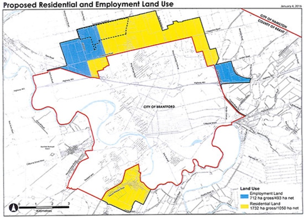 This map from the City of Brantford shows the lands being transferred to the city from the County of Brant. Yellow areas will be earmarked for residential development, with blue areas designated as employment lands.
According to a joint press release, about 62.5 per cent of the total land being transferred is developable land.
In the same release, Brantford Mayor Chris Friel called the signing a “momentous” moment for both communities.
“Together we stand at the threshold of a future more certain to deliver mutual prosperity and a high quality of life and caring for all of our citizens,” he said.
Two public meetings regarding the boundary changes are being planned for the coming weeks. Details of those are available at the city’s website.


