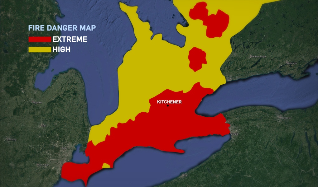
Here’s an indicator of how dry it’s been this month.
If a forest fire started Tuesday in Waterloo Region or certain other parts of southern Ontario, the persistently dry conditions mean it would be very difficult for it to be extinguished.
Natural Resources Canada releases daily updates measuring what it calls ‘fire danger’ – which measures how easy it is for trees and other vegetation to ignite, as well as how damaging such a fire could be and how difficult it would be to control.
Tuesday’s map showed an “extreme” level of fire danger – the highest rating possible – for Waterloo Region and areas to the south and east, including Brantford, Guelph and Hamilton.
Huron-Perth, Grey-Bruce and northern Wellington County were rated two steps lower, at “high”.
Fires sparked under extreme conditions are considered to be intense, fast-spreading, very difficult to control and impossible to fight directly.
Fires sparked under high fire danger conditions, by contrast, are said to be “challenging” but not impossible to fight, although an aerial attack would be a necessary part of the firefighting effort.
Based on forecasts available as of Tuesday afternoon, the fire danger rating for southern Ontario was expected to remain at least at high until Friday, with an extreme danger persisting in some areas east of Waterloo Region.
According to Environment Canada, less than 40 mm of rainfall has been recorded at the Region of Waterloo International Airport so far this month, with only 11.5 mm falling since June 8.
Bans on open burning – outside of barbecues and small campfires – remain in effect in Waterloo Region’s townships and Brant County.


