Another round of wet weather moved into southern Ontario again Thursday, with strong winds prompting advisories for the Niagara Region and City of Hamilton.
In Waterloo region, conditions are expected to continue to clear through the afternoon and evening, making way for some sunshine. If it seems to you like we’ve already had our fair share of messy April weather, you’re not wrong.
However, with just over a week left in the month, Waterloo region has received less than half of what’s average for April precipitation.
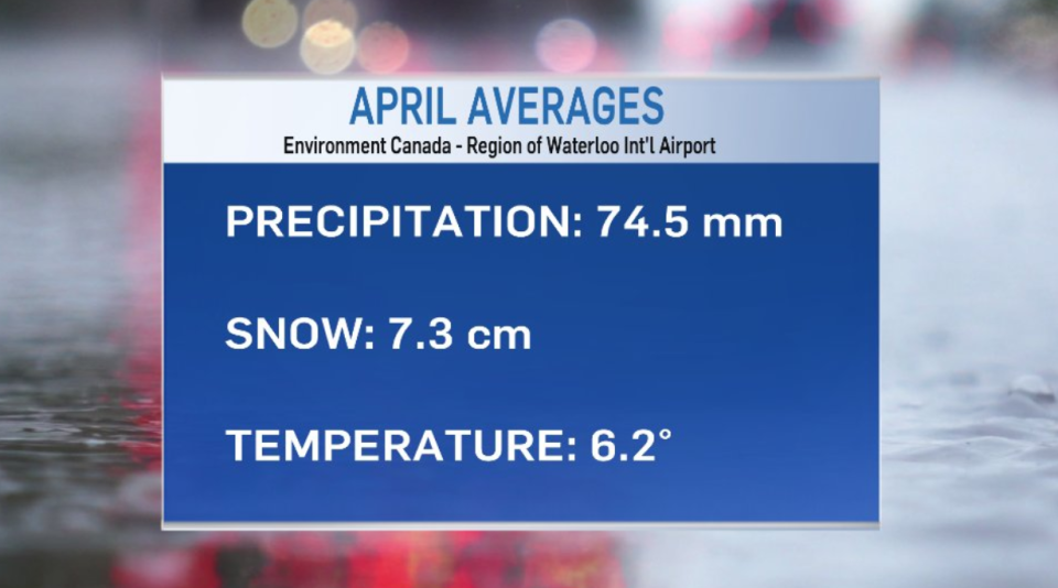
According to observations collected at the Region of Waterloo International Airport, the region has recorded 23.7 mm of precipitation so far in April, not including the Thursday April 21 rainfall. That 23.7 mm, includes the water equivalent of total snowfall, like the 5 to 10 cm we received earlier this week.
As for the mean temperature, this year is slightly below the average of 6.2 C, at 4.4 C so far. Our highest temperature this April was 21.4 C on April 13. The lowest temperature recorded this month was -5.7 C on April 4.
So, technically speaking, this April so far hasn’t been too bad. Although, there’s still time to surpass some of those April averages mentioned above.
Perhaps it’s the wind making some days seem a little unpleasant. During the first 20 days of April – excluding three days where observations were missed – 14 days saw wind gusts over 40km/h. On six of those days winds were clocked at over 50km/h.
As the spring rollercoaster continues, a welcomed high in the low 20s is forecast for Sunday. We will see some above and below seasonal temperatures return as we approach May – and noticeably more daylight! Sunrise in the region is currently at 6:30 a.m., while sunset occurs at 8:11 p.m.
We are in April after all, and you know what they say – April showers brings May flowers.
Anyone else ready for the flowers?


