KITCHENER -- Waterspouts over Lake Huron on Monday provided a sight for many, with reports from several communities along the shoreline. Environment Canada had issued Tornado watches for parts of Grey Bruce, Dufferin and Simcoe Counties as conditions were favourable for the development of funnel clouds and waterspouts.
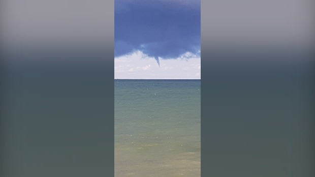
(Courtesy: Rob Page)
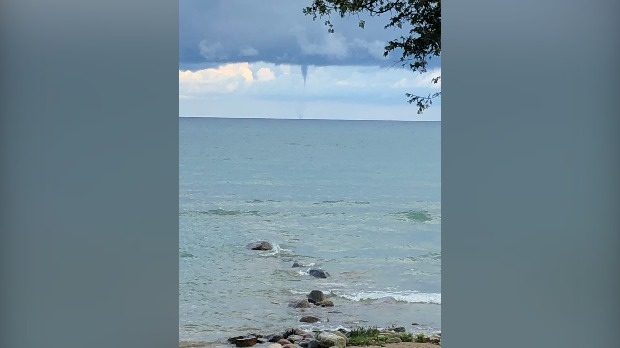
(Courtesy: Jeff Turner)

(Courtesy: Grace Moogk, Point Clark)
The tornado watches dropped off Monday afternoon, but were replaced with severe thunderstorm watches and warnings as storms with heavy rain, strong winds and in some cases hail moved through southern Ontario. The risk of thunderstorms will end Monday night, with partly cloudy skies and fog patches developing through the overnight hours.
Stay up-to-date on alerts here.
SUNSHINE IS ON THE WAY
Behind the cold front, temperatures will be slightly below seasonal and even show a glimpse of early fall-like weather on Tuesday. The high for Waterloo Region is 22 C with an overnight low of about 9 C. Temperatures gradually warm up as we near the weekend while conditions clear out with an abundance of sunshine in the long range.


