KITCHENER -- Although the day was warm and sunny to start, severe thunderstorms fired up in the afternoon and evening across much of southern Ontario.
Several alerts were issued including tornado watches and warnings, severe thunderstorm watches and warnings as well as special weather statements.
Many areas reporting torrential downpours, strong winds and hail.

The heat and humidity helping to fuel the severe storms as a cold front passed. The temperature at the Region of Waterloo Int’l Airport climbed to 24.4 C Friday afternoon, coming so close to breaking the previous record of exactly that, 24.4 C set back in 1920. The humidex value climbed to 30 during the mid-afternoon.
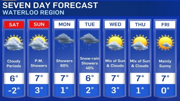
Temperatures take a tumble behind the cold front and remain in the single digits for the next several days, with overnight lows near the freezing mark.